
Cape Town – The South African Weather Service has issued multiple weather warnings and advisories, cautioning residents in parts of the Eastern Cape and Western Cape to brace for severe and potentially disruptive conditions in the coming days.
In its latest update on Sunday afternoon, the weather service announced a Yellow Level 2 warning for severe thunderstorms over the central regions of the Eastern Cape.
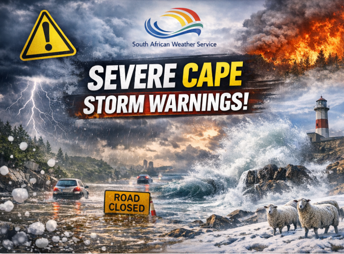
The storms are expected to bring heavy downpours that could result in localised flooding of roads, bridges and low-lying areas. Strong winds and hail are also anticipated, raising the risk of damage to infrastructure and informal settlements.
Authorities further warned of extremely high fire danger conditions in the eastern parts of the Eastern Cape, urging residents to remain vigilant and avoid activities that could spark fires.
Looking ahead, the SAWS said an intense cut-off low pressure system is forecast to affect large parts of the Eastern Cape and the eastern regions of the Western Cape from Tuesday evening through to Thursday.
The system is expected to bring widespread adverse weather, including heavy rainfall, strong inland winds, gale-force coastal winds, rough seas, and potential storm surge along the coast. Disruptive snowfall is also possible in high-lying areas.
The weather service has advised members of the public, particularly small stock farmers, to take precautionary measures to safeguard livestock, property and infrastructure.
Residents are encouraged to stay updated with official weather alerts and heed safety warnings as conditions develop.
Follow African Insider on Facebook, X and Instagram
Picture: Copilot
For more African news, visit Africaninsider.com
Compiled by Betha Madhomu