
Cape Town – The South African Weather Service has issued a warning over an approaching cold front expected to impact parts of the Western Cape and the Namakwa region in the Northern Cape from Sunday afternoon.
According to SAWS, the system is forecast to bring rainfall of between 20mm and 40mm to the south-western parts of the Western Cape, accompanied by strong winds across inland areas.
Winds of 40 to 50km/h, with gusts reaching between 70 and 90km/h, are expected over the southern Namakwa region and the Central Karoo on Sunday.
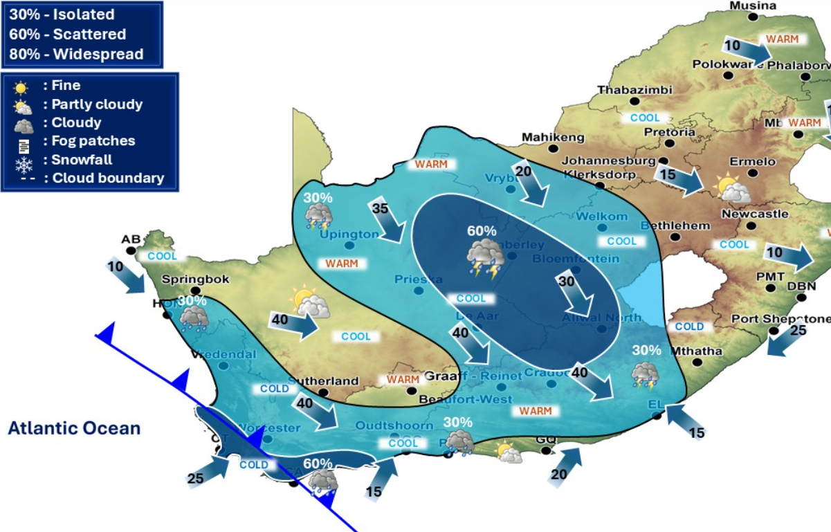
Weather outlook for Sunday & Monday, 26 – 27 April 2026.
Partly cloudy & cold to cool, but warm in places in the extreme eastern parts of RSA with isolated to scattered showers & thundershowers over the central & western parts of the country. #saws #weatheroutlook pic.twitter.com/TqqrRFWj15— SA Weather Service (@SAWeatherServic) April 24, 2026
The cold front is also set to cause a significant drop in temperatures on Monday, with daytime highs expected to fall to 10°C or below in the Karoo Hoogland Local Municipality and the Witzenberg Local Municipality. These cold conditions will be accompanied by wet weather and winds of around 30km/h.
Along the coast, hazardous sea conditions are expected, with south-westerly swells of between 4.0m and 5.0m forecast between Saldanha Bay and Plettenberg Bay.
The weather service said partly cloudy skies with cold to cool temperatures and isolated to scattered showers and thundershowers are expected over the weekend as the system approaches.
Residents in affected areas have been urged to exercise caution, particularly in coastal and high-wind regions.
Follow African Insider on Facebook, X and Instagram
Picture: X/@SAWeatherServic
For more African news, visit Africaninsider.com
Compiled by Betha Madhomu