
Cape Town – Possible extreme weather is expected to affect parts of South Africa in the coming weeks, following a significant drop in temperatures recorded by weather services.
This signals the arrival of a powerful cold front that will bring extreme rain and snow.
MEDIA RELEASE: A spell of extreme winter weather starting this weekend, with snowfalls possible over all provinces, except Limpopo pic.twitter.com/FlHRWp3rLY
— SA Weather Service (@SAWeatherServic) June 5, 2025
According to the South African Weather Service (SAWS), a strong cut-off low-pressure system is expected to hit the country in the coming days. This system will bring with it severe winter conditions, starting in the Western and Northern Cape, before moving eastward to affect the central and eastern provinces.
“Early on Saturday morning, 7 June 2025, this system will begin affecting the Western and Northern Cape.
“By Monday, 9 June 2025 and Tuesday, 10 June 2025 this extensive and severe winter weather system will have shifted further east over South Africa, affecting the central and eastern provinces.
“A significant and dramatic drop in daytime temperatures can be expected over all provinces, with the possible exception of Limpopo”, reported SAWS.
❄️ UPDATED: ADVANCED SNOW FORECAST | 8–10 JUNE 2025 ❄️
‼️LIFE-THREATENING SNOW POSSIBLE FOR PARTS OF THE EASTERN CAPE & LESOTHO‼️
📅 Valid: 5 June 2025
📢 Keep an eye on our daily updates as this forecast could change quickly with the developing cut-off low system. pic.twitter.com/XaF5NrqLxx
— Vox Weather (@VoxWeatherZa) June 5, 2025
SAWS has urged farmers to take precautionary measures as the upcoming extreme weather could result in losses of livestock and crops.
The following impacts are expected, according to SAWS:
-
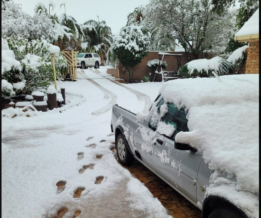
Snowfalls are forecast in every province except Limpopo. These may disrupt traffic flow and mountain passes.
-
Heavy rainfall is expected in the Eastern Cape and KwaZulu-Natal, particularly in the northern coastal regions of the Eastern Cape and southern parts of KZN. This may lead to localized flooding and infrastructure damage.
-
Strong winds will affect large interior areas of all provinces from Sunday, increasing the risk of wildfires and bringing bitterly cold daytime conditions, with temperatures unlikely to exceed 10°C.
-
Severe thunderstorms, possibly accompanied by hail, are likely over parts of North West, Gauteng, Mpumalanga, and KwaZulu-Natal on Monday and Tuesday.
SAWS predicts that these extreme conditions will persist in the Eastern Cape until Wednesday, 11 June.
Follow African Insider on Facebook, Twitter and Instagram
Picture: X/@EBthewarrior
For more African news, visit Africaninsider.com
Compiled by Anda Tolibadi