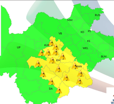
Johannesburg – Several South African provinces face severe thunderstorms, damaging winds and extremely high fire danger on Monday, 26 October, with weather warnings highlighting the risk of localised flooding, infrastructure damage and disruptions to transport.
The South African Weather Service (SAWS) has issued a Level 2 warning for severe thunderstorms over most of KwaZulu-Natal, excluding the extreme north-east, and the extreme northern parts of the Eastern Cape.
The forecast warns of heavy downpours, damaging winds, hail and lightning, which could cause localised flooding and damage to settlements and infrastructure.
A Level 1 warning for damaging winds also applies to western parts of the Free State and the extreme eastern parts of the Northern Cape. The conditions could affect agricultural production and transport routes through falling trees and dust storms.
Yellow level 1 warning: Damaging winds
Affected area: Central interior
Validity period: 26 October 2026.
#saws #weatheroutlook #southafricanweather https://t.co/URS7z7UgAu— SA Weather Service (@SAWeatherServic) October 25, 2026
Extremely high fire danger conditions are expected across North West, central and eastern Northern Cape, most of the Free State and Limpopo, as well as parts of western KwaZulu-Natal.
The outlook presents a mixed picture across the country, with Gauteng expected to experience warm to hot conditions and isolated afternoon showers in the south, while Limpopo is forecast to be fine and hot to very hot. Parts of Mpumalanga, North West and the Free State could also experience showers and thunderstorms.
Follow African Insider on Facebook, X and Instagram
Picture: X /@SAWeatherServic
For more African news, visit Africaninsider.com
Compiled by Betha Madhomu